It was time to start digging. Dig deep.
We’d talked to neighbors and area well drillers about what they had on their land, and what had been produced, in water wells. An Indian Casino had gone in less than 10 miles away, that farmer’s were worried would suck all the local wells dry.
Neighbor’s were only getting marginal water (low flow and poor tasting, iron-containing staining water) in the 150 ft range. So some issues to consider. We didn’t want to tap into water that would draw down our neighbors, draining them dry of the little they had.
Ain’t Cheap, That’s for Sure!
At roughly $60 a foot, it would be very expensive to drill. $6,000 for every 100 ft. The well driller recommended 200ft. and estimated we would get 35 gallon per minute (GPM). At that flow rate we would not have to put in extra equipment for fire backup. Of course, a total guess based on who knows what, but probably to give us the lowest possible estimate to get a well in. And NO, no guarantees. But, they could get the permit and be ready to drill in less than a month.
(Our first well drilling venture, in Hopland 2005… it took us three years to get a water well drilled! Need I say that we learned a few lessons along that road!)
This well drilling estimate looked good except that it did NOT include actually getting any water out of the ground… which would require a well pump, power, lines, etc. Whole other issues there.
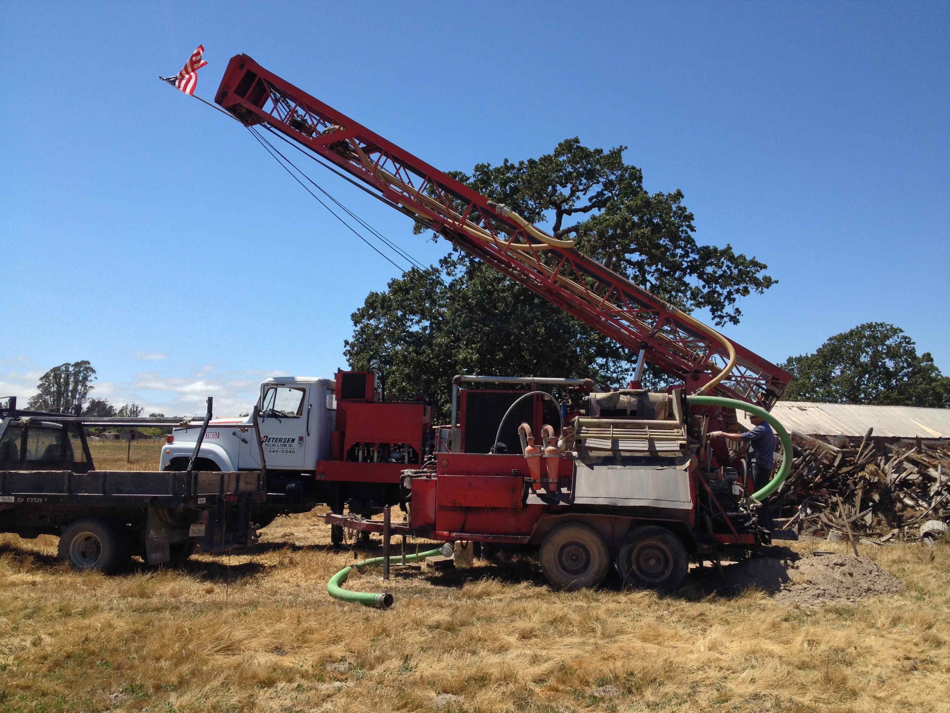
Great folks to work with, Peterson Drilling (in business for over 50 years). Showed up on time, knowledgeable and willing to discuss the whole process. If you know me, I was in hog heaven! Someone who would explain their work and the processes involved.
They brought in close to a million dollars worth of equipment (today’s costs to replace the equipment) to start to

Drill Rig setting up
drill. Before they began, raised an American Flag to the top of the drilling rig. American business doing real work producing something.
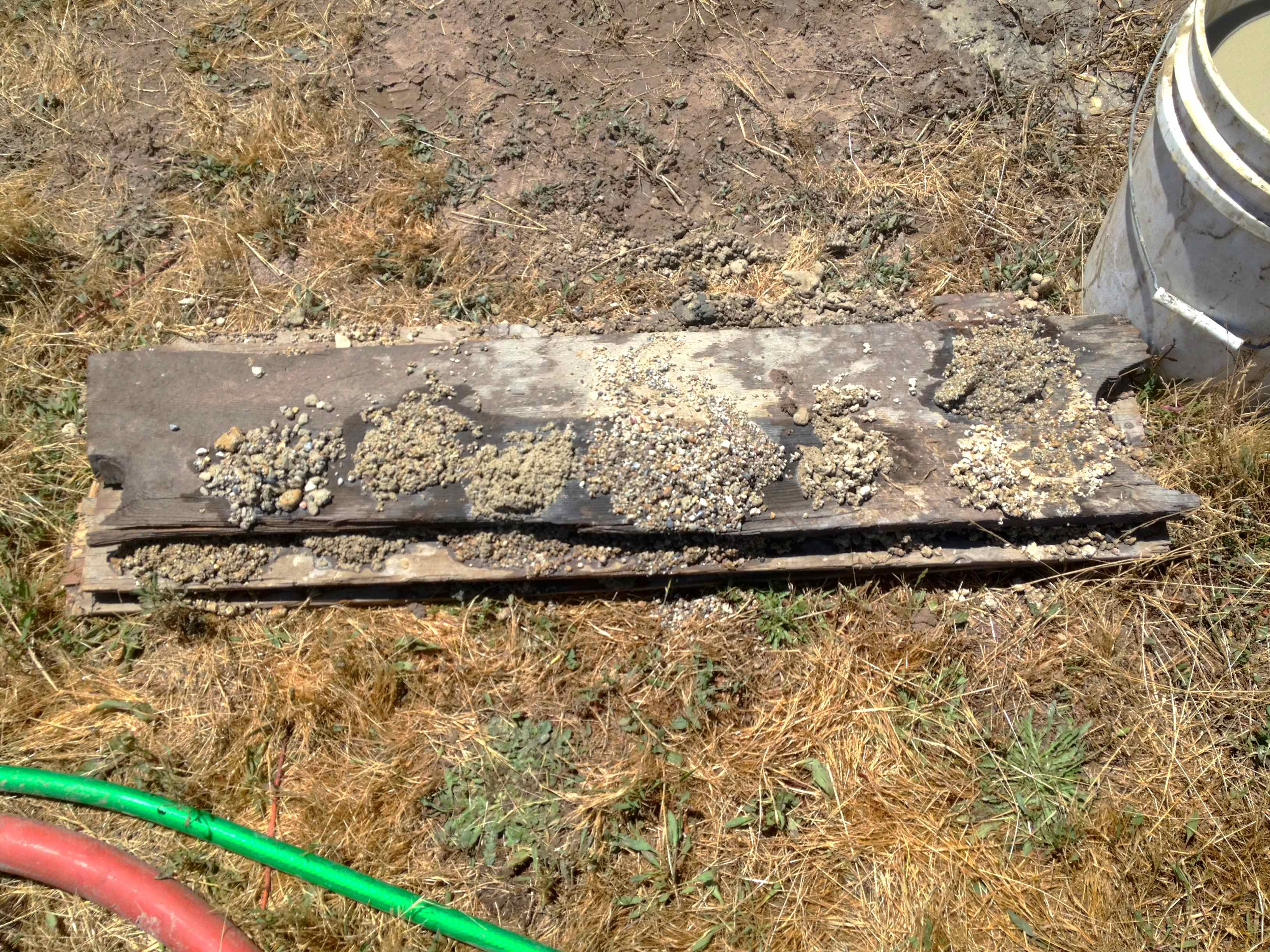
Over four days, they sunk the drill bit through layers and layers of various soil textures. Along the way they took samples of the “spoils” coming up, and built a pattern of the different layers underlying the property. Some layers the drill bit moved through quickly, other’s it just crawled. The operator making notes along the way of each change he observed in the “spoils”.
Often you could just “hear” the change in the drilling process to know that the underground terrain had changed. Think about it, you are going back hundreds and thousands of years as you move through those layers.

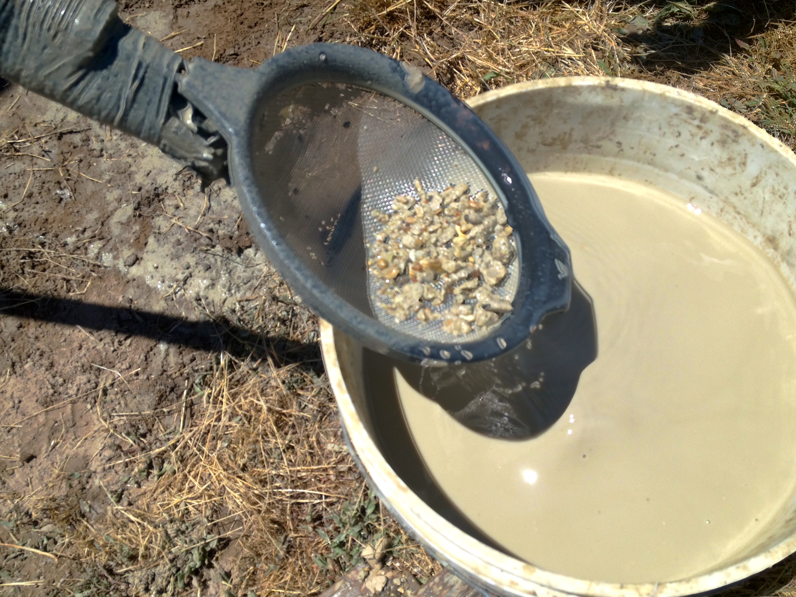
straining the spoils
Scientists have taken the drill logs of over 8,000 different drillers, through out California, to build a picture of the underground layers and see the story they tell.
Building a Picture of the Underlying Layers
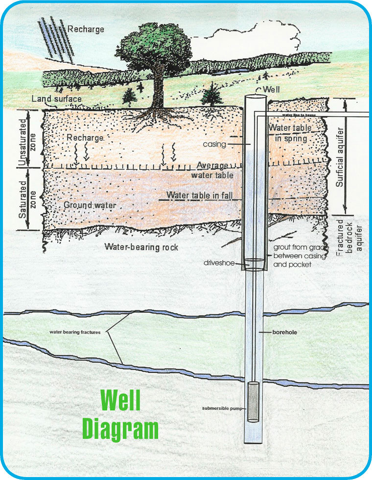
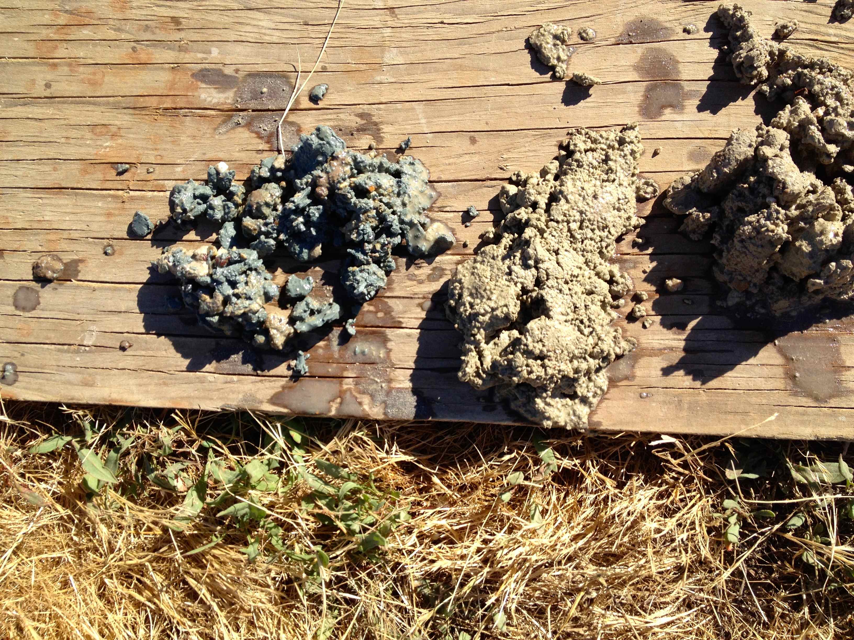
For us, the first 50 ft were sandy loan, perfect for growing crops. Well drained. This area had been an old flood plain so sedimentary soils had build up over time. And then we hit a clay layer, a creamy beige layer followed by a dark blue layer of clay. The drillers called it “blue clay” and said it came from an ancient swamp land that had decomposed.

Clay ~ blue, white, beige
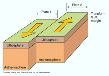
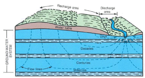
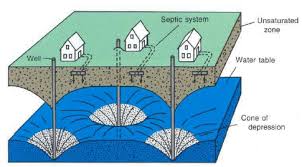
Blue clay is a “plastic layer”, a layer that water can barely penetrate. Instead of water moving many feet a day through the soil, this layer effectively blocked movement. Limiting it to 1-3 millimeters over a timeframe of a 100 years. Water under this layer is basically ancient water that is not being recharged The layer above this was the layer my neighbors had been, and still were, in.
Water “spaces” collapse
The problem with the soils & water withdrawals? As water was removed, the soil particles compacted in and stuck to each other which prevent water from being reabsorbed into the soils, assuming it could even get there. (Maybe by pumping excess water back into the ground during the rainy season?)
We kept going deeper. I did not want to be in a water reservoir that the neighbors were drawing on. We needed to go past another clay layer (i.e. through the bottom layer of that upper water reservoir). A lower level would be a ‘contained’ reservoir, blocked from moving up by the clay layers above it; we would not be pulling out any of the water in the upper reservoir they were located in.

Boards stacked with Layers of Spoil Samples
We hit the 200 ft level. No. Not far enough down.
Good water bearing rock should be gavel-like in texture, some sand is ok, but small rocks are better. Allows water to collect in the spaces and not as likely to compact down and prevent future water movement. Still no sense of any good layers of water bearing material. Driller said, “I’m sure there IS water; how much or the quality? I have no idea.”
Keep going… I named 300 ft as the end point. Somewhere between 200-300 feet we needed to find the right texture make-up of the layers. I had to leave… couldn’t take the watching & waiting. I just knew I had committed our limited resources to the edge. We either got a return on it, or not (if we didn’t or if it was just minimal, it would severely limit what we could do with the farm land.)
Besides, I figured it was the ol’ boiling water figure of speech…. watching it wouldn’t make it happen any faster.
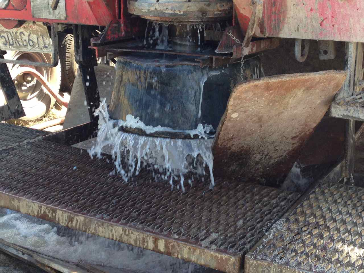
It was the middle of the 3rd day. They would finish drilling and then start pumping water INTO the well to flush it out, and see what we would actually get.
Flushing the Well with Water
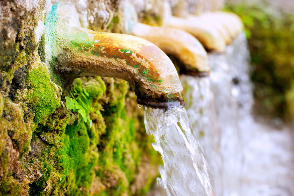
I came back. As I drove up, I could see the well head gushing water out. They had placed a black tub on top to direct the water downward into the mini-drainage canal they had built at the start, to channel all the “spoils”.

Water, water
Asking the driller how much longer they had to flush the well before we would know how much water we would get; he laughed, “honey, that’s not water we are flushing the well with, that IS your water coming out.” I was shocked, stunned… on the verge of tears, actually.
I had prepared my self for a dribble, 3-4 gallons a minute that with a storage tank, you could get by on.

confined by upper & lower levels of clay
He was telling me we had a 100 GPM flowing from the well, of good water. No sulfur, no iron, just pristine water.
Ancient water that did not have hormones, antibiotics, industrial chemicals leached into it, protected by the upper layers of clay.
We even had enough water that we would be able to share with our neighbors.
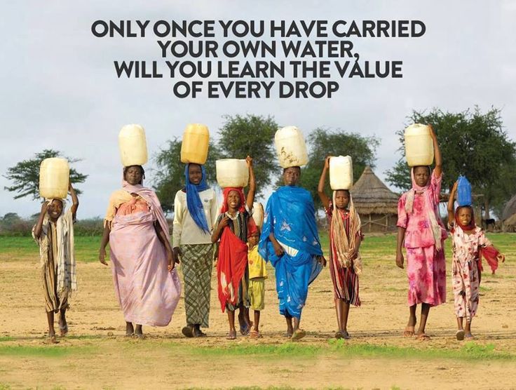
Severe Drought in a Desert State
Why was I so shocked? Here we are in the middle of the worst drought in California in over a hundred years, and we actually found water. Turns out in the last 100 feet they drilled, roughly 85 ft of it was water-bearing material. They hit another thick clay at 307 ft and stopped at that point.
Management becomes the key issue. And will be an interesting point for discussion. How should water be managed? and why?
Water management in the past, and the future…
Land has dropped 30 ft/50 years
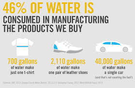
In the Central Valley of California (Sacrament Valley & San Joaquin Valley, 20-70 miles wide by 400 miles long) agriculture there has resorted to pumping from the aquifers to feed the water hungry farms. Of course that valley production provides a quarter of the food for the entire country. Move over one valley closer (cooler) to the coast, to Salinas and farmers produce close to 90% of some crops to the entire US. If you eat, a good portion comes from California farms.
Ground water, for years, has not been able to meet the needs of the industrial sized farms, despite building huge canals and moving water directly to the area.
The largest number of well permits ever issues, has occurred in the last two years. Wells are being drilled to a 1,000 ft or more, as the surface wells (to 300 ft) dry up.
Land subsidence is dramatic; certain areas have dropped some 30 ft in the last 50 years. In the last 3 years of this drought, the land is collapsing in at the rate of a foot a year; as the water is removed, the land subsides.

collapsing layers as the water is removed
Because it is becoming compacted it can never again hold water in the volume it has held in the past. This is happening in a relatively progressive state.
Ogallala Aquifer, largest in the USA, is already being pumped dry…
It has already happened in the mid-west where one of the world’s largest aquifer is located. The Ogallala Aquifer, spanning eight states, has been drawn down to a quarter
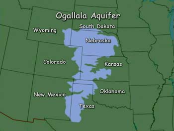
Ogallala Aquifer – spanning eight states
of it’s initial size, in less that 60 years of intensive farming. Estimates mark 2028 as the expected date for the water to be gone.
Water that took thousands and thousands of years to collect… gone. It would take a 100,000 years, it is estimated, to replenish the water naturally. It recharges at roughly one inch a year; while being drawn down 5 ft a year, in places.
Contamination ~ no way to undo that damage
The other danger? They want to build the Keystone XL pipeline right through the land the overlies the Ogallala Aquifer. Don’t worry, “we won’t let it contaminate the water” by leaking into it! Right, as if I believe that one. If it happens, it’s something you can’t take back. Is that a gamble you want to take? Just how much DO you trust cost conscience corporations?
It is the time for each one of us to begin to say, it’s enough. It’s time to start thinking and acting sanely.
You say, “It’s the corporation, it’s big business, it’s someone else’s problem.” But if you drive, if you heat or cool your home, if you eat food… you ARE part of the issues. It is time to start taking responsibility for what needs to happen, on a local level. If you are waiting for big government to make changes, they won’t until you make it happen.
California Gold, in a Desert State, is called WATER
So I look at my “California Gold” and am reminded of my responsibility to the future… it forces me to consider a broader picture than just me and my “tribe”. The need to chart a path that builds resilience for the future rather than just doing the traditional “taking” today, for me and mine. Actually, it’s what we all need to be doing, and doing it actively before we have no more choices.


 huge beehive complexes that are 5 – 15 stories high apartment complexes, packed shoulder to shoulder to each other.